Directional Drilling in Chattanooga
A city wrapped in a river bend beneath sandstone tablelands — the Tennessee sweeping around Moccasin Bend and out through the gorge — in the town that gave America its first citywide gigabit. Scenic City HDD is gorge-and-plateau drilling in the country's original fiber city — and it's ours.
HDD is the whole job here
Chattanooga's geology is scenery you can bill against: the Cumberland Plateau's sandstone tablelands — Walden Ridge, Signal Mountain, Lookout, Sand Mountain — stand over a limestone valley floor where the city lives, and the Tennessee River threads it all, wrapping Moccasin Bend and exiting through the gorge that made the town a gateway. The drilling reads the elevation: valley alignments work flat-lying limestone country — ledges at variable cover, chert-laced red residuum above, and the dissolved-rock behavior that limestone valleys keep, priced with void-aware manners; plateau and brow alignments meet the caprock's sandstone and the boulder-strewn slopes below it; and the river corridor adds alluvial terraces where the bends deposited them. Elevation-honest quoting — valley, slope, or tableland — is the local grammar.
The market carries a distinction no other metro can claim: this is the Gig City, where the municipal electric utility built America's first citywide gigabit fiber network — a community that treats fiber as public infrastructure, reads conduit drawings fluently, and keeps a smart-grid-plus-broadband plant in continuous expansion. Layer on the freight crossroads (I-24 meeting I-75, rail heritage the town literally sings about), the Volkswagen plant and its supplier orbit, TVA's headquarters presence with the dams that pool the river through town, and the Georgia side's growth running from Ringgold to Fort Oglethorpe, and you have a two-state market where TDOT and GDOT paper flows through one desk — ours — with each state's machinery named per crossing.
The river's pools set the water story: Chickamauga and Nickajack hold the Tennessee at managed elevations through the metro, which turns river work into TVA-world work — reservoir rules, navigation, and the gorge's dramatic geometry. Behind it all sits the network desk — 50,000+ boring calls answered, ~10,000 crossings quoted, 2,000+ drilled — pricing Scenic City scope with the elevation already in the math.
Fiber-Optic Boring
Duct in the Gig City: expansion-grade builds, campus laterals, and two-state FTTH.
Electrical Duct Boring
Smart-grid duct, plant and freight-belt feeders, and ridge-tested hardening.
Water & Force-Main Boring
Pressure pipe across valley grades and ridge shoulders for two states' systems.
Tennessee River Crossings
The signature Scenic City bore: under the pools, the bend, and the gorge's water.
Road & Highway Crossings
City and county streets, TDOT and GDOT spines — benched, permitted, priced honestly.
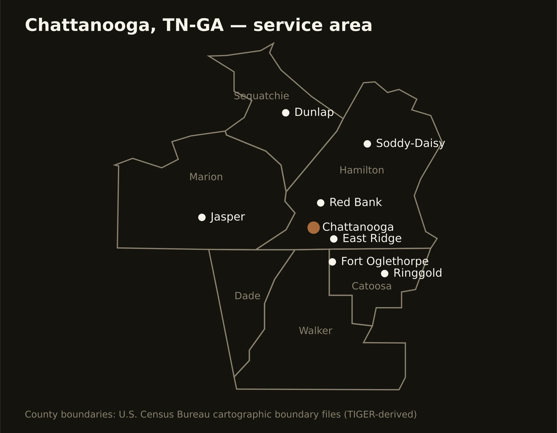
Six counties in two states — Hamilton wrapping the city and its ridges, Marion and Sequatchie holding the gorge and the plateau's great valley west, and Catoosa, Dade, and Walker carrying the Georgia side from Ringgold to Lookout's back slopes. Full county list on the service-area page.